PeakFinder GmbH
PeakFinder Customer Service

- PeakFinder Customer Service
- PeakFinder App Comments & Reviews (2026)
- PeakFinder iPhone Images
- PeakFinder iPad Images
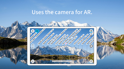
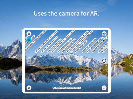
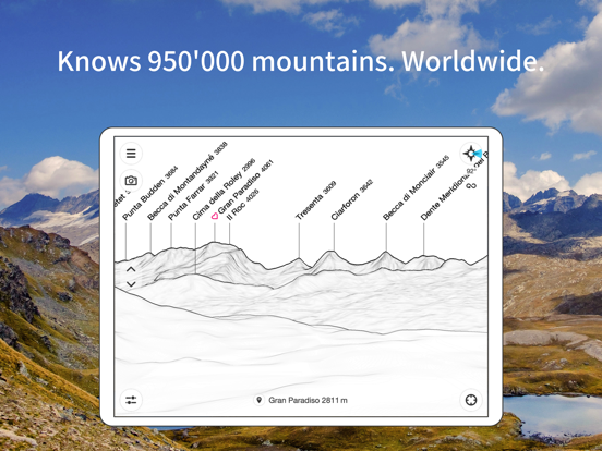
The mountains are calling! Explore more mountains than any mountaineer! PeakFinder makes it possible… and shows the names of all mountains and peaks with a 360° panorama display.
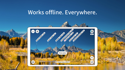
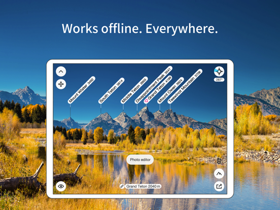
This functions completely offline - and worldwide!
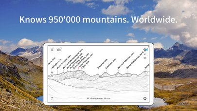
PeakFinder knows more than 1'000'000 peaks - from Mount Everest to the little hill around the corner.
•••••••••
Winner of several prizes like 'Best of AppStore', 'App of the Week', …
Highly recommended by macnewsworld.com, nationalgeographic.com, smokinapps.com, outdoor-magazin.com, themetaq.com, digital-geography.com, …
•••••••••
••• Features •••
• Works offline and worldwide
• Includes more than 1'000'000 peak names
• Overlays the camera image with the panorama drawing
• Realtime rendering of the surrounding landscapes in a range of 300km/200mil
• Digital telescope to select less prominent peaks
• 'Show me'-function for visible peaks
• Selection of the viewpoint by GPS, the peak directory or an (online) map
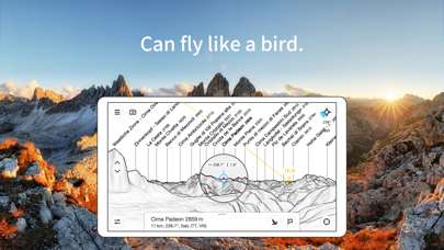
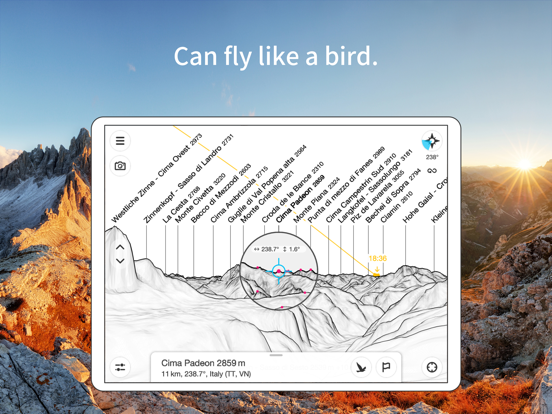
• Can fly like a bird from peak to peak and vertically upwards
• Mark mountains and places you like
• Shows the solar and lunar orbit with rise and set times
• Uses compass and motion sensors
• Daily updates of the peak directory
• Does not contain any recurring costs. You pay only once
• Is free of advertising
••• Ratings •••
Every good rating (including those following updates) makes me happy. The positive ratings and reviews make it possible for me to continue to improve the app for you. Many thanks!
••• Support •••
In case of questions, problems, mistakes, missing mountain names and ideas for future expansion, I am happy to help you. Please write to [email protected].
PeakFinder App Comments & Reviews
PeakFinder Positive Reviews
Great AppThis is highly useful for Landscape Photography and Hiking interest and outdoors nature enthusiast. I live around mountains and on rare days when there is clear skies I like to be in the sunlight during the winter and that’s hard find. The app tracks where the sun and moon are from any point you choose geographically. You can easily plan where the rise or set alignment of those celestial body’s will be relative to land features around your point selection. If you wish to share a live landscape photo with the peaks labeled you can do that, and for long thru hike trips you can locate which peak is which in the far distance, and this is also useful for map navigation . If you’re cleaver you can use your screen video record to show the peaks labeled live as you pan the horizon. You don’t need internet connection while using this app..Version: 4.8.21
A joy to useI rarely write app reviews because so many apps of a geographical nature are very close to being awesome, but tend to be overpriced, lacking in some basic and obvious feature, or have some major glitch. I’m frequently disappointed, but don’t want to discourage developers. In designing a home, this app has succeeded where a dozen other highly technical apps have failed, to give me quick information about features on the landscape, their general appearance and orientation. The camera is intuitive and the function to adjust the position of the features to match the camera view very easy to use. Not only is this useful in a practical sense, it is fun, and I find myself opening it up all the time to better understand my landscape. Please don’t change the essence of this app! It is great as it is..Version: 3.6.3
What I’ve always wanted - in app form!I’ve been a very satisfied Peak Finder user for many years. I’m usually one to write reviews, but this app is cool that I want to. So many times over the years I’d sit on a mountaintop, staring out at a vista, and think “wouldn’t it be cool if the mountain names could just pop up above the peaks??”. Peak Finder does just that! It’s really pretty incredible that I can carry this technology in the palm of my hand out in the wilderness. You can also take photos with the labels on them, and even get the names of further off peaks by zooming in on the saved pic later. If you love the outdoors and maps, do yourself a favor and get this app! Also, the price is low and worth every penny..Version: 4.7.12
One of my favorite appsThere are very few apps out there that do their job so well you barely notice them. Almost every app has some little niggle. This is one of those apps. One of its best features is actually its secondary feature: sun and moon path representation. If you ever want to know “when is the sun going to hit my tent” or “where do I have to be so the moon rises behind that mountain for my perfect photo”, this is the app for you. One of the top negative reviews has to do with aligning peaks. Unfortunately, that user probably has used magnetic phone mounts and screwed up their hardware. I’m on my >=10th iPhone and this is the first time I’ve had any issues (MagSafe is pretty good at balancing that effect, but not perfect). True, there’s no image detection with auto alignment, but the line drawing is clear and easy to match up. This is especially useful in areas where the DEM just isn’t accurate. (The other comment about screenshots is many years out of date.) I bought this app for cheap years ago and it was easily one of my best purchases ever..Version: 4.7.6
Excellently executed appThis app does a great job of presenting a large amount of data in an accessible manner. I’m amazed at the detail they have. I never knew several of the smaller hills and lower peaks on the mountains around me had names. I appreciate the links to where they got that data as well. On that note, the only thing I can think of that would make it better is the ability to add the local names of peaks. It’s a bit jarring to see peaks you’ve climbed a hundred times and looked at every day with names you’ve never heard of..Version: 4.8.20
Great App butGreat app but I really find the interface confusing. I stumble through getting an overlay on a camera view, taking a pic and saving it to my camera role. It seems tha camera blanks out or the MT Range traces disappear …. When it works it is great. I also Hate the way it loads data. I am in Sicily now with limited Data access. I visited Etna, and even though I downloaded the data when I had wifi and was a few miles away, the app wanted to download data. I said “no” . It asked me again. I said “no” It asked me again……. And even though I said NO over and over it continued to download my data and used my entire roaming allocation. That ruined my day as I lost access to google maps etc..Version: 4.8.18
Yikes!Update: I’ve deleted and reinstalled the app again. It seems to be working for the most part! I’ll see what happens when I travel next week. I saw a few posts about it getting “stuck” in a location. I think maybe that’s what mine is/was doing? Original: I don’t know what it is about this app but it’s never worked for me. I’m often in southern CO, northern AZ and southern NV and it’s laughably wrong. I’m currently in NV and it’s telling me peaks in Vegas are actually peaks from central CA! It’s like this all the time. It’ll tell the mountains in front of me are actually 10 mile behind me, etc. Yes, it’s updated. I’m using an iPhone 11 Pro, do not have a magnetic case, and all of my other apps that use GPS/compass work perfectly fine..Version: 4.2.20
I Show It Off Every TimeOne of my favorite apps of all time! Every time I’m on top of Genesee Mountain or Evergreen Mountain, I “wow” anyone who seems to be enjoying the view by showing them Peak Finder. They can’t believe what this app can do, especially the “fly to” feature. That usually gets the most emphatic response. Who knows how many people download this app after I show it to them...hopefully a lot! For 29 years, I’ve always wondered how far from my house it is to the top of Mt. Evans. And now I know with Peak Finder that it’s exactly 21 miles..Version: 4.4.18
Long-time PF user, suddenly in love with PeakFinderToday I went hiking here in Colorado. As I often do, I opened PeakFinder to figure out what peaks are which. Ordinarily, this was a frustrating process, because when I hold my iPhone 7 vertically, the compass doesn't work, and it was hard to look back and forth to match the outlines with the view. Today, WOW, augmented reality! I can see the view _and_ the info all together, right on the iPhone! Suddenly, it was easy to align the peaks to the view on the screen, and voilà! In seconds we identified each of the twenty peaks we could see, even the distant ones that were barely visible behind the others. We all were dazzled! Each of the five people on the trip said they'd be buying PeakFinder. If you love mountains, check it out. Even if you're not sure, I hope you get to see it in action some day. If you do, I'm certain you'll be buying it, too..Version: 3.2.7
Love this appPeakFinder is both an invaluable tool and a delightful toy. In the wilderness it is an incredible orienteering tool. If you enjoy maps, you will love PeakFinder, guaranteed. One suggestion for the team to consider: it would be neat if your GPS position was indicated on the terrain when “flying” to other peaks in the area. If I jump from Mount Foo to Peak Bar I can look back and see Mt Foo, and I think it would be nice if there was also an indicator of “that’s where I am!” With or without that suggestion this is an amazing app. Kudos to the team.Version: 4.4.9
Great appReally shows off the synergy between GPS, a camera, accelerometers, gyroscopes and an amazing database. I use it whenever I’m on vacation and take pictures in the mountains: just take a screenshot of the app looking at the same area you’re taking pictures of and you have a perfect record later on of what you were looking at. I add it to all my vacation albums. And everybody you show it to is just amazed at how well it works. A couple of minutes after I show them, they’re downloading it..Version: 3.2.11
ImpressiveEver look at the horizon and wonder what mountain/hill you are seeing? Now you can. With this app you can match the contours you see on the screen to the mountain tops in real life. It accurately shows you the mount tops you are looking at. Can very useful when you are hiking and trying to get your bearings (but always bring a paper map for back up!) or to learn what you are looking at when you get on top of that peak!.Version: 4.8.21
Great app, one requestLove this app, but one request! It looks like the app uses GPS to find your location, but it assumes you are on the ground. Would it be possible to use either GPS altimeter or baro altimeter to approximate your actual altitude? I use this app from my plane when I’m flying and want to know what peak I’m looking at. But the perspective always assumes you are on the ground looking up at the peak. If it could adjust the perspective for the viewers actual altitude would be perfect!.Version: 4.2.19
Thanks for a great app!Kudos to Peakfinder! I’ve been using Peakfinder for nearly 10 years and it has always excelled at identifying peaks for me whether I’m in Maine, Colorado, Wyoming, wherever. Recently the old version that I had installed failed because it was no longer supported. Fabio Soldati of Peakfinder responded promptly and provided a free update. I really appreciate this since not all developers stand by the original purchase when it has “aged out.” Thanks, Fabio!.Version: 4.8.29
Love this appI’ve been using this app for ages. So often when we travels there’s an impressive or unique peak that we wonder about. With this app, wonder no more! It’s like magic, point your phone and it overlays the horizon. Adjust slightly and boom! Peak names. Last year I even started taking some photos through this app and it will overlay peak names. Always impresses people when I share those..Version: 4.8.44
Convenient to use without internet connectionI would give Peak Finder 5 stars, except that during the summer of 2019, with a certain update, the functionality of saving Favorites was lost on my iPad Air 2. Nevertheless, downloading the “map drawings” for a certain area allows one to “see” the landscape and identify many mountains, hills, and buttes. A very useful tool in conjunction with a standard map. Thank you!.Version: 4.1.6
App finesse!So much attention to detail, from the fluid movement of the view, to the artistic sketch style of the display, and now with AR! It is humbling to think of all the calculations and sensing that’s going on behind this beautiful interface. They say technology advances by increasing the number of things we can do without thinking about it. PeakFinder has definitely advanced technology. It’s an app worth seeing, even if you’ve never wondered “What’s the name of that lump?”.Version: 3.2.11
Seems to work greatWorks great, worth the money. Only thing that I wish it had was when you are looking at the topography map, if it wasn’t just white and actually had an option for color data from google maps, that would look better for pictures. Overall very good app though!.Version: 4.4.18
A nice app but could use a filterThe camera feature is great for areas that don’t have many mountains, but using it in the Pacific Northwest makes it incredibly difficult due to the number of peaks. The app could really use a filter feature, for example hiding mountains over 50 miles away, less than 2500 feet, etc. I searched for this option on the app and couldn’t find it. If it’s there, they could make it easier to find..Version: 4.7.23
Great updateThis has long been a favorite app for traveling and hiking. Very helpful in conjunction with maps to get your bearings or just answer the question, "what is the name of that mountain?" To be honest, I thought it was a five star app before this upgrade. Adding the camera and the ability to make slight adjustments to more accurately track the terrain is brilliant. You don’t need this app, but you will want it!.Version: 3.2.7
Incredible App!I’m obsessed with this app. As an avid outdoors-person and backpacker, this shares invaluable information not just about peaks, but the path of the sun and moon, with rise and set times and *where* they will rise and set. All of this info can be set up to be viewed offline (make sure to select the locations from the quadrants given for download)! Awesome awesome app..Version: 4.8.21
Simple and very effectiveI’ve tried learning/using several apps for planning location photoshoots, but none does it as easily and quickly as PeakFinder. I may open those others if I wand different info, but PF usually gets me all I need to know in much less time. Thanks to their team for this irreplaceable tool..Version: 4.8.47
Terrific productFantastic way to learn more about the environment I’m in. I’m surrounded by mountains in the Intermountain west and in order to learn what I can see in Peak Finder I would have had access to scores of topographic maps. Really enjoy being able to have the mountains in my photos labeled to show family and friends. Also helpful in teaching my daughter wayfinding skills..Version: 4.1.6
Great app that is indispensable for people like meI've always loved the app and when I had an issue with it the dev personally reached out to me via email to get feedback and implemented the change within a month or less. They really care about making a great product and it shows..Version: 4.8.64
OutstandingPeak Finder has been my go to application now for identifying mountain peaks all over the world both on the ground and in ‘ far away’ locations. Its cool to take a picture of a mountain scene and then, later on, identify the mountain peaks. The application has served well both on the ground and remotely in South America, Africa and North America. Keep up the good work!.Version: 4.8.15
PerfectI use this app all the time. I hike a bunch in the mountains and being able to see the names of adjacent peaks helps me decide where to hike next. I’ve recommended this app to everyone I meet on the trail. Now that the developer has added AR and other features everyone who I show it too is very impressed. Such a simple idea but so cool. Keep up the good work!.Version: 3.2.8
Even works in Wisconsin!I don’t use PeakFinder a lot, not many mountains in Wisconsin, but it is by far my favorite app. I am forever demo’ing it to friends showing them the ar function by finding our famous Blue Mounds which rise about 950 feet above sea level. Yep, PeakFinder finds it! Can’t wait until I go to Alaska this spring. If I were forced to bring only one app, this would be it!! Awesome app!!.Version: 3.2.11
Spectacular app!Not only does this beautiful app have wonderful uses, it's so lovely to look at that I could just spend ages playing with it. Wonderful! Highly recommended for literally anyone-- whether you are just curious as to what that mountain over there is called or if you're a landscape photographer seeking the perfect vantage of a scene. Just fabulous..Version: 3.2.8
Works well internationally too…I use this in the US a lot, and was delighted how well it has worked in other countries. I kept wondering which volcanoes i was seeing in Guatemala, a quick download of software and there you go, now you know. One of the best outdoors app I’ve purchased. Thanks..Version: 4.7.23
Love “Real” Sun & Moon rise-set times!Very useful and fun app👍🏽 Love that it gives Sun & Moon times on the visual horizon of wherever I am for setting up camp for views and morning sunrise. Very useful for learning peaks WAY in the distance. Incorporating the camera view great for later reference of landscapes of trip photos is brilliant idea. Well done 🙏.Version: 4.8.50
Nice app & feature requestThis app works well and is fun and interesting. One feature request would be to add a setting for a compass ‘offset’. My device has a bogus compass that I cannot calibrate properly (tried many things short of buying a new phone) and if I could just add in a correction factor that would be great!.Version: 4.8.18
Fun and informative!Have been using for a while on iphone6 .. other than a little trouble getting the image registered with the visible mountains (often in remote locations with negligible cell service), it has worked very well. It is really fun to be able to put a name on mountains both familiar and new!.Version: 3.2.11
Incredibly Fun AppPeakFinder is great fun and never fails to impress friends and strangers! The developer adds sensible new features that keep it current and relevant, but not bloated. For example the ability to take annotated photos or to chose a viewpoint anywhere in the world from a map. Don’t hesitate on this one, highly recommended..Version: 3.9.2
This App is AwesomeUsing this is fairly intuitive and it’s so cool to be able to see the names of all the peaks as well as their elevation. One caution, make sure you are on WiFi or have strong signal to download the current location map database..Version: 4.8.29
So Much Fun and HelpfulI’m really enjoying this app. A friend recommended it to me and I’ve spread the word and recommended it to many of my friends. No matter where we are I can find out the names of the mountains around us. We are going to Idaho this summer and I can’t wait to use PeakFinder out there. Really a good app..Version: 3.6.4
Amazingly usefulThis app has helped me identify peaks countless times on hikes. I often take photographs on hikes, and thanks to PeakFinder I now know what I’m shooting! Best of all, we traveled to Taiwan, and after downloading the data I could get the same information there! Amazing..Version: 4.2.28
Worth every penny and way moreThis is a fantastic app!! As another reviewer said, it’s a joy to use. I pull this app out constantly while hiking and I know all the peaks that I can see in my area now. I love this app!! Can’t recommend it enough!.Version: 4.8.16
Highly recommendedI can’t recommend this app enough. It is incredibly functional and, after reviewing the clear and simple instructions on the developer website, easy to use. And it’s just plain fun for any level of explorer..Version: 4.2.17
I love this APP!It’s great to use, either in the field or from the couch. (That’s the canned response - but I agree with it completely.) Any mountain loving person should have this. I hope the developer is rewarded enough so it doesn’t go away!.Version: 4.8.50
Almost epicAmazing. Been using got two weeks, most days and can say it’s a really helpful and fun tool for adventuring. The app shows info of already named peaks and would be better if there were a way to get details on additional landmarks.. ones I chose.Version: 3.8.1
Amazing!PeakFinder is such a cool app. The recent updates have greatly improved it from the older buggy versions. I would still like to have the ability to download multiple regions at the same time or have an easier format for downloading other regions that you plan to visit..Version: 3.5.0
One of my favourite tools.Living along the Canadian Rockies, I’ve found this app an app solute gem. So many peaks that went decades unnamed in my mind, are slowly becoming recognizable landmarks, helping me make a mental map of the various front ranges. If mountains are your thing, I cannot recommend enough..Version: 4.3.2
Must buy for anyone living near mountains!I live in the Canadian Rockies and this app is the most useful and coolest app ever..Version: 4.6.7
Make sure to initialize before your hike!It’s fantastic and I love it, but I made a very silly mistake...I didn’t download the map data within the app prior to leaving for my first hike..Version: 4.2.17
Really cool app! One issueThe app is really cool and for the most part works really well. I haven’t had a chance to take it out to the mountains with me yet but importing my own pictures and liking them up with the overlay quickly shows the names of all the peaks around me. The only issue is that when I export the image back it only exports 16:9 aspect ratio even if I selected 4:3. Also in the 16:9 exports the top of the image where the labels actually are gets cut off. So it’s really good for personal use but I can’t really share my pictures with the overlay..Version: 4.8.25
AmazingI use this app every time I'm on a hike in our Canadian Rockies. It's totally awesome to be at the top of a mountain and being able to see the names of the peaks all around you and way off into the distance. The AR function rocks..Version: 4.1.6
Great appI enjoy being able to see which mountains surround me.Version: 4.2.14
Most useful application of AR I’ve ever experienced!!This app blew my mind! It was so shockingly accurate and made looking out at the mountains SO much cooler to know what all the mountains were. I can not recommend highly enough!.Version: 4.1.6
Highly recommendedI never hesitate to show friends in the Canadian Rockies how valuable this app is. As someone who likes to bag peaks it’s great getting to find out what exactly I’m staring at on the horizon. The latest update brings another level of detail and recognition to the peaks, truly an incredible app, totally worth paying for..Version: 4.0.4
Dream come true.I’m a Banff nerd. I’m out in the Park every few weeks or so. After a while you learn all the famous peaks’ names, but this is just super useful. The offline feature and the skyline overlay in AR mode, so you can quickly calibrate, are what sealed the deal for me. Everyone’s getting this for Christmas..Version: 3.2.11
Like it but...Know that you have to be able to see the PEAK of the mountain to be able to get the name...in a valley that can be frustrating because you know the mountain is there...but you aren’t looking at the actual peak of the mountain. I believe...although have yet to try...that you can use the flying mode to get higher in valleys so you can see the peaks..Version: 3.3.8
Amazing so usefulI use this app constantly in the city and on hikes. It is super fast and doesn't need a constant data connection. It quickly shows all the peaks in my area / elevation and the renderings are gorgeous. I would only suggest and augmented reality feature where the outlines are superimposed on the camera image.Version: 3.1.4
Awesome backcountry app that just keeps getting better!Awesome backcountry app that just keeps getting better!.Version: 3.0.7
Awesome!I don't know why everyone is giving it one star and complaining, unless they don't know how to use it. Take a couple of minutes to learn how to use it properly. Download your coverage, make sure the viewpoint is actually your location and it's facing the direction you want it to, it's fabulous for offline use. Can also click on any mountain and it will take you to the peak, useful to see what the skyline looks like and what other peaks are visible from the top..Version: 2.6.0
This is the app I've been looking for.Ever since Google Earth came out, I've wanted something that would name peaks in the real world. This is that app. So cool. Make sure you set it up the first time..Version: 2.6.0
One of my favourite appsAs a lover of mountains I have looked for a way to identify peaks around the world. And in Peakfinder I found the perfect solution. I tested it in areas I know really well and am astonished about the accuracy of the information I get. I looked at mountains in Switzerland as well as Western Canada and the Northwestern US. "Amazing" is the word that comes to mind...Version: 2.6.0
Free International Money Transfer 💸Enjoy high maximum transfers into more than 20 currencies while saving up to 90% over local banks! The cheap, fast way to send money abroad. Free transfer up to 500 USD!Version: 4.8.73