 OnWater, LLC
Paddle Ways - Paddling Info Customer Service
- Paddle Ways - Paddling Info Customer Service
- Paddle Ways - Paddling Info App Comments & Reviews (2024)
- Paddle Ways - Paddling Info iPhone Images
- Paddle Ways - Paddling Info iPad Images
PaddleWays serves as your indispensable digital guidebook and GPS navigation tool for your whitewater adventures. Whether you're into kayaking, rafting, canoeing, or stand-up paddling, PaddleWays has got you covered. Developed in collaboration with American White Water, this app provides vital information to ensure safe and informed decisions before your water float trips.
Explore Exciting Paddling Destinations
Discover a variety of river sections, as well as rivers and lakes, both nearby and farther afield, with our interactive maps. Delve into guidebook descriptions, assess your skill level with provided difficulty ratings, and access related resources for comprehensive insights.
Effortless Trip Planning
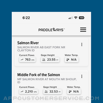
Plan your perfect outing with confidence using PaddleWays. Calculate river miles, access thousands of points of interest, such as access points, boat ramps, campsites, and more. Save your favorite river sections, check real-time weather conditions, and monitor river flow rates (CFS) by location to identify the ideal time for your water float trips.
Seamless Navigation
Navigate with ease through detailed interactive 2D and 3D maps, accessible both online and offline. Choose from Satellite, Outdoor, and Street map modes, measure distances in river miles, and set location-based alerts for upcoming take-outs, campsites, or rapids.
Connect with the Paddling Community
Stay informed through user comments on recent conditions and reference notes, photos, and saved locations from your previous trips. PaddleWays is more than just an app; it's an interactive atlas and community forum created for paddlers, by paddlers.
Meet PaddleWays
PaddleWays is powered by NRS, committed to making human-powered recreation more accessible, safe, sustainable, and enjoyable. Utilizing technology developed by onWater, PaddleWays donates 1% of sales to promote responsible use and resource conservation.
PaddleWays Plus
Upgrade your experience with a PaddleWays Plus subscription, offering access to premium features, including offline maps, river guidebooks, real-time flow data, and public & private land data.
Discover the ultimate tool for your whitewater, kayaking, and rafting adventures. Download PaddleWays today and embark on waterborne journeys like never before.
Terms of use: https://paddleways.com/terms-and-conditions
Paddle Ways - Paddling Info App Comments & Reviews
Paddle Ways - Paddling Info Positive Reviews
Excited to see where this goesHopping into the beta test for this - so if you’re reading this review in the future and I haven’t updated it yet, keep that in mind. I have high hopes for this app! Maybe it’ll be like alltrails for paddling. Things I think need some work currently: Needs more content. Only one route near me, but I know of so many more. The boat launch drop in/out locations should have addresses and an info page for parking, restroom access (if any), fees, photos. I’d love to see the ability for users to create their own routes. Lakes should be listed too, with boat ramp info. I SUP a lot on local lakes. It’s strange to me that there isn’t much of a navigation bar - I haven’t paddled yet but I would hope that the app will be able to record my route, and save that in a log. It would be awesome if it had some functionality similar to Strava for cyclists where you have your own profile and can follow others, share your routes etc. Another neat feature would be something similar to Waze where users could mark hazards on the route or create comments for others like “if the water is low stay left here” Pros so far: The app is smooth. No ads are a big plus. The map is beautifully done. I like the list view option (but it should tell me how far the route is from my current location too) This is an awesome concept that paddlers have needed for far too long!.Version: 1.1.4
Maps ok database needs workThe maps look good and points of interest appear accurate (MapBox) but the trips database is weak. For example the Lower Deschutes is described as one trip of 110 miles. It is actually a day trip and two overnights with a mandatory exit at Sheers Fall. I noticed several other similar issues in other rivers. Some of the data appears to be from the AWA. They should get more data from similar sources. The free trial may be crippled too much to properly review but not enough there to justify going for a year subscription even with the 50% discount at this point..Version: 1.1.2
Cool ConceptVery cool concept. I think it has the potential to be the all in app for everything needed for whitewater paddling if a few things were improved. Continue to look for contributors to add data on rivers since the current data is very lacking. I’d say look to at least have what American Whitewater has in terms of data covered and then continue to add to that with local experts. Next, I find adding data is a bit difficult to be able to scroll down and hit submit. Lastly, in order to be in the premium category, I’d maybe consider teaming up with rain pursuit to get map overlays showing accumulated rainfall. This can help for those runs that don’t have a corresponding USGS gage. I think if the goal is to have this be one stop for paddlers this stuff is a must to get them to spend the money on the app. The ability for users to update will be helpful as well..Version: 1.1.5
Killer App! Love it!This app was literally so helpful on our last five day river trip! The GPS location works the whole way, and really helped us figure out stopping points, great beaches, and helped us better time manage our trip! I can’t wait to see them expand into more rivers throughout. it’s definitely worth the small fee per year! Very few complaints for such a new app! I would like to see a check-in point at different beaches, so people will know what beaches are taken. It also needs to be fine tuned in accordance to the BLM and forest service maps..Version: 1.1.4
Keep it up!I love what this app has going so far…maybe they could have saved themselves some of the more mean-spirited reviews by putting BETA in all caps all over. For the info so far it’s a great way to navigate to see different river conditions. Easier than the web browser pages many rely on. I hope this can become a one-stop shop for gauge, CFS, put-in/take-out, parking, restrooms, fees, so we’re not jumping around different apps and sites to plan trips. Meanwhile I appreciate that the named rapids in the Lehigh are marked!.Version: 1.1.5
Offline Maps UselessThe best part of this app would be the offline maps - however if you zoom in enough to actually differentiate between the points of interest (camps, rapids, etc) in an offline map, the points of interest disappear. Could be a great useful tool… eventually. Also, would be nice if I could download specific sections of rivers. I don’t need to download the entire Salmon River (ID) if I’m only boating on the Lower Salmon section..Version: 1.0.5
Has potentialUnless paying the app doesn’t let you see much, currently it’s not worth it to pay for the subscription but that may change as it receives updates..Version: 1.1.5
Stoked to see where this goes!I’ve been looking for an app that makes getting on the water easier. I’m stuck in a rut of going to the same place to paddle over and over again..Version: 1.3.2
Great Job!These people are doing a really great job with this app so far. I'm just starting out rafting and I really appreciate all the super useful information I've gotten so far. Thanks for the good work! Totally worth the cost..Version: 1.1.5
Love the vision!!This is an ambitious undertaking and will be AWESOME once y’all get it all fully filled out! Y’all keep up the good work and don’t let the negative reviews, while it’s all still in beta, get ya down…keep pushing! 🙌🏼.Version: 1.1.2
Has promise, but needs workI agree with a lot of the comments about the need for more rivers,etc. My constructive criticism is that while the interface looks good on my iPhone, it is almost unusable on my iPad. I have the large screen pro with tons of memory and the latest iOS. It looks like a blown up phone screen but half the words are only visible. While I’m excited to use it ob my phone, I’d prefer to do any trip planning on the larger screen of the iPad. I cannot talk to whether this is an issue on any other platform (android, etc.).Version: 1.1.5
Free International Money Transfer 💸Enjoy high maximum transfers into more than 20 currencies while saving up to 90% over local banks! The cheap, fast way to send money abroad. Free transfer up to 500 USD!Version: 1.3.5
What do you think Paddle Ways - Paddling Info ios app? Can you share your thoughts and app experiences with other peoples?
Please wait! Facebook comments loading...


